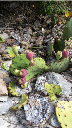
Ah, the great state of Texas.You really surprised me with a fantastic hike. I hope to return to explore more of your trails. Don't let me down! Chalk Ridge Falls Park 5600 FM 1670 Belton, TX 76513 (254) 939-2461 Free Entry The endless research I did on this trail was outdated and not so helpful. All I knew going into this hike from what I found through Google searches was that it had been closed down for a little while, it had a waterfall, it had a cool suspension bridge, there was a cave(s) somewhere along or right off the trail, and there were apparently 5 miles of trail. Let me clear things up. It was closed down for awhile for repair after a flood in 2007 but is now open (obviously) and has been open since about May of this year. From other stuff I've read it can be closed after lots of rain because its prone to flood and is also on the other side of a dam. There is definitely a waterfall. Definitely beautiful. Definitely easy to find. There is a suspension bridge that is in full use. It is not broken and it is safe to cross. The 5 miles of trail seems plausible but I'm not quite sure as to what they're referring to. The trails immediately around the river couldn't have been more than three. There were some trails beyond the waterfall that we walked for less than half a mile before turning around because we felt like we were in the desert and there really wasn't anything to see. So that may be what they're referring to.You'll just have to do your own exploring in that area. We found a cave.....way off the trail. Keep reading for more info on that. To the Waterfall 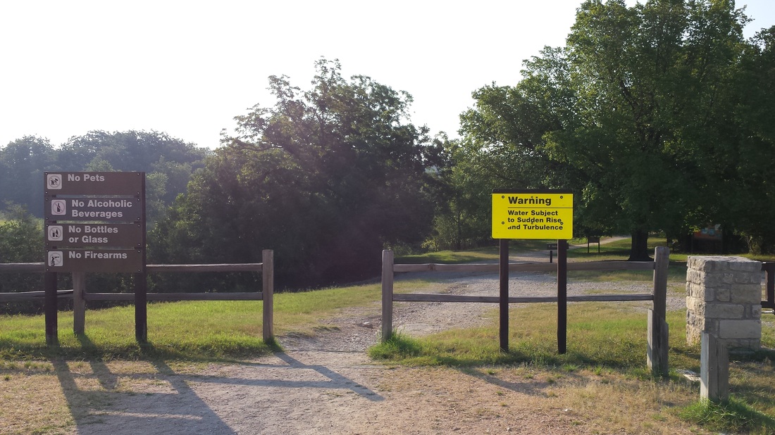
Trailhead
The drive to Chalk Ridge Falls is beautiful. You drive over a dam with a royal blue lake on one side and the park on the other. There's a small paved loop with parking and restrooms right next to the trailhead. Not too far in you can either choose to walk on a trail right next to the water or stay on the larger trail just parallel to it. We went down to the water's edge to explore but came back up not too much further down the trail. It says the trail is marked but we only saw a few posts with colored markers on them. The main trail is clear though so it wasn't much trouble. Soon you'll find yourself at the waterfall. It's better than some of the reviews gave it credit for. Its not the same as a tall towering waterfall but it has its own beauty. If you try to travel too far past the waterfall you hit a fence marking the edge of the park's property and you have to turn around. This must've happened to us about three times while we were trying to explore and find the suspension bridge. But wait there's more! Read on for the neat little features of this trail and how to find them. Recommended Route Cliff and Bridge From the trailhead follow the main trail to the waterfall. Once you get to the waterfall keep walking a little further up the water's edge and you'll come to what I believe is a small dam. Cross it carefully. Now you'll be on a smaller trail. Follow it to the left where you'll come to a small 'cliff' that overlooks the river. Move on and you'll eventually find yourself at the suspension bridge. Brave the shaky contraption and keep following the trail which brings you back to the waterfall. This nice quick loop shouldn't take more than 30-45 minutes if you keep a steady pace with no detours. Cave Now...if you're up for a whole 'nother adventure go back to the wooden walkway/bridge that you crossed on the way in that had a staircase leading down to the ground. There is no clear trail here but if you look you'll find a faint 'trail' that leads into the woods. Follow it. Eventually you'll end up in what looks like a dried up river bed. Perfect place for caves right? Also the perfect place for snakes. We only encountered one so just keep an eye out. We followed the river bed for quite some time determined to find a cave and we did! Its not huge but it was fun to explore and rewarding to finally find. Keep in mind the riverbed has absolutely no shade. Bring plenty of water and sunscreen if you plan on setting out for the cave. This is the part I DO NOT recommend. Especially if you're an avid 'leave no trace behind' person and if you generally don't like getting slapped in the face by branches. We were running out of time (we had a 6 hour drive home) and had no clue how far this river bed went or where it came out so we decided to climb into the trees to take a shortcut back to the car. Using the gps on my phone we trekked through pretty dense Texas wilderness. For awhile I followed my husbands every step because I figured he was finding the easiest route but it wasn't working out so I decided to try my own (which is what you 'leave no trace behind' people should do, if you ever go off a path take different steps than the person in front of you so you don't pack the soil and create a new path). Next to each other we forged our way through the trees, ducking and hopping around obstacles. It felt like walking through a spider web of pointy branches. Again, not recommended. We finally made it through and began our 6 hour journey back home. I give this trail 4 sunshines 
4 out of 5
Have you ever explored the area around this trail? Tell me what you've found!
32 Comments
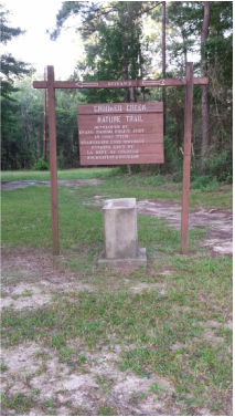
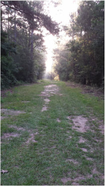
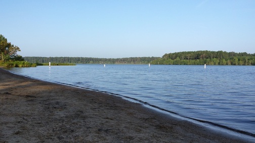 This picture makes the "beach" look much nicer than it was. This was taken at 7am when no one else was there. This picture makes the "beach" look much nicer than it was. This was taken at 7am when no one else was there. Crooked Creek Recreation Area 1300 Sandy Beach Dr Ville Platte, LA 70586 (337) 599-2661 Crooked Creek is exactly what it sounds like. When I first heard the name visions of hillbillies danced in my head and I might look into the psychic business because my visions came true. We encountered a special kind of racist that we disliked. Don't get me wrong, people of all kinds of strange can be found at almost any campground, especially the more secluded ones, that doesn't mean the camp is ruined. But there were a few other things about this site that made it a little less than pleasant. This campground was designed more for campers and RVs. The few tent spaces were called 'sheds', a picnic table with a tin covering surrounded by some land and sprinkled with trees. These sheds cost $22. If you have more than one tent you have to pay the $22 per tent even though our 'shed' could have easily fit 5 or more. The shed that we ended up with was conveniently close to the "beach" they had and also convenient for other campers to walk through. Let's just say it didn't provide much privacy. The "beach" was an area on the shore that they covered in sand and put buoys around to mark a swimming area. (buoy is a funny looking word). The lake water was maybe two degrees cooler than the outside temperature and if you ventured too far to the right you ended up in nasty, slimy muck. I know, I know, it's a part of the great outdoors. Apparently this wasn't enough to keep people away though. They had visitors who would just come to swim for the day on top of the individuals that were actually camping there all enjoying the lukewarm lake on the tiny beach. The icing on the cake was when I stepped out of the water and looked like a bear because this dark brown dirt was stuck to every hair on my body. Fun. I've swam in lakes before but none like this... On the pamphlet they have in the front office they advertise a nature trail. So naturally when I was the first one to wake up I got up to explore. We had come across a large sign that said nature trail the day before when hunting for fire wood so I returned to the trail head. I was very quickly disappointed. I didn't go very far into the trail because I felt like it would have been a waste of time. The "trail" was wide enough for a car to fit through. My assumption was that they had to make a passageway for a vehicle at some point in the history of the campground and they just named it a nature trail. Both sides are lined with tall trees and absolutely nothing to see. There was however an unmarked trail in another location worth exploring. If you're facing the beach and you look to the left towards the treeline you'll see some small trail heads, one of which you can see a bridge. Take the time to investigate these trails. I enjoyed it.
I give Crooked Creek campground 2 Sunshines! 
2 out of 5
Have you been to Crooked Creek? What did you like about it? Tell me in the comments!
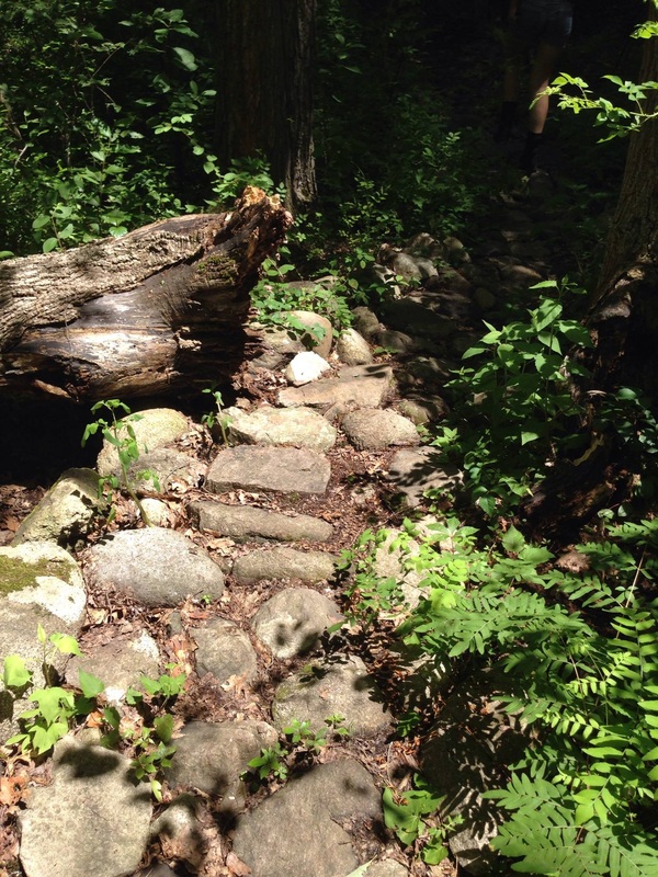 Rockland Trail North Av Conservation Land North Ave Rockland, MA 02370 This trail in Rockland Town Forest in Rockland, Massachusetts is quite magical to say the least. After being away from the New England terrain for a decade it welcomed me back with open arms and made me one happy hiker. Who knew rocks could make someone so happy?! Let me count the ways I loved this trail. Number one: The trail was so well maintained and clear that colored blazers weren't even necessary. There was one tiny little section maybe three feet long that had over grown plants in the trail. Don't worry, my sister and I made it out alive ;) Number two: The rock lined pathways and cute little bridges that crossed the small peaceful stream made this trail come alive. If you're a nature lover you won't want to leave these whimsical paths. Number Three: The three trails that make up this area are all connected in loops making it easy to walk all of them without having to go through any parts of the path more than once. The three trails together also make it the perfect length for a quick hike. I think it took us about 45 minutes to do all three, and that's counting stopping to take 60 photos and enjoying the scenery. I don't want to give too much away because the discovery was the best part of this hike. Its a super easy trail to enjoy on a relaxed day. Have fun and happy hiking! Have you been to this trail? Let me know about your experience! I give this trail 5 sunshines!  |
“Keep your face to the sunshine and you cannot see a shadow.” - Helen Keller 

AuthorMy name is Jessica. I live in Louisiana. I love exploring the outdoors and sharing my experiences. Archives
April 2015
Categories
All
 |
 RSS Feed
