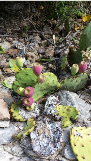
Ah, the great state of Texas.You really surprised me with a fantastic hike. I hope to return to explore more of your trails. Don't let me down! Chalk Ridge Falls Park 5600 FM 1670 Belton, TX 76513 (254) 939-2461 Free Entry The endless research I did on this trail was outdated and not so helpful. All I knew going into this hike from what I found through Google searches was that it had been closed down for a little while, it had a waterfall, it had a cool suspension bridge, there was a cave(s) somewhere along or right off the trail, and there were apparently 5 miles of trail. Let me clear things up. It was closed down for awhile for repair after a flood in 2007 but is now open (obviously) and has been open since about May of this year. From other stuff I've read it can be closed after lots of rain because its prone to flood and is also on the other side of a dam. There is definitely a waterfall. Definitely beautiful. Definitely easy to find. There is a suspension bridge that is in full use. It is not broken and it is safe to cross. The 5 miles of trail seems plausible but I'm not quite sure as to what they're referring to. The trails immediately around the river couldn't have been more than three. There were some trails beyond the waterfall that we walked for less than half a mile before turning around because we felt like we were in the desert and there really wasn't anything to see. So that may be what they're referring to.You'll just have to do your own exploring in that area. We found a cave.....way off the trail. Keep reading for more info on that. To the Waterfall 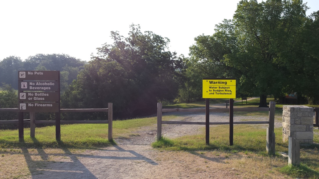
Trailhead
The drive to Chalk Ridge Falls is beautiful. You drive over a dam with a royal blue lake on one side and the park on the other. There's a small paved loop with parking and restrooms right next to the trailhead. Not too far in you can either choose to walk on a trail right next to the water or stay on the larger trail just parallel to it. We went down to the water's edge to explore but came back up not too much further down the trail. It says the trail is marked but we only saw a few posts with colored markers on them. The main trail is clear though so it wasn't much trouble. Soon you'll find yourself at the waterfall. It's better than some of the reviews gave it credit for. Its not the same as a tall towering waterfall but it has its own beauty. If you try to travel too far past the waterfall you hit a fence marking the edge of the park's property and you have to turn around. This must've happened to us about three times while we were trying to explore and find the suspension bridge. But wait there's more! Read on for the neat little features of this trail and how to find them. Recommended Route Cliff and Bridge From the trailhead follow the main trail to the waterfall. Once you get to the waterfall keep walking a little further up the water's edge and you'll come to what I believe is a small dam. Cross it carefully. Now you'll be on a smaller trail. Follow it to the left where you'll come to a small 'cliff' that overlooks the river. Move on and you'll eventually find yourself at the suspension bridge. Brave the shaky contraption and keep following the trail which brings you back to the waterfall. This nice quick loop shouldn't take more than 30-45 minutes if you keep a steady pace with no detours. Cave Now...if you're up for a whole 'nother adventure go back to the wooden walkway/bridge that you crossed on the way in that had a staircase leading down to the ground. There is no clear trail here but if you look you'll find a faint 'trail' that leads into the woods. Follow it. Eventually you'll end up in what looks like a dried up river bed. Perfect place for caves right? Also the perfect place for snakes. We only encountered one so just keep an eye out. We followed the river bed for quite some time determined to find a cave and we did! Its not huge but it was fun to explore and rewarding to finally find. Keep in mind the riverbed has absolutely no shade. Bring plenty of water and sunscreen if you plan on setting out for the cave. This is the part I DO NOT recommend. Especially if you're an avid 'leave no trace behind' person and if you generally don't like getting slapped in the face by branches. We were running out of time (we had a 6 hour drive home) and had no clue how far this river bed went or where it came out so we decided to climb into the trees to take a shortcut back to the car. Using the gps on my phone we trekked through pretty dense Texas wilderness. For awhile I followed my husbands every step because I figured he was finding the easiest route but it wasn't working out so I decided to try my own (which is what you 'leave no trace behind' people should do, if you ever go off a path take different steps than the person in front of you so you don't pack the soil and create a new path). Next to each other we forged our way through the trees, ducking and hopping around obstacles. It felt like walking through a spider web of pointy branches. Again, not recommended. We finally made it through and began our 6 hour journey back home. I give this trail 4 sunshines 
4 out of 5
Have you ever explored the area around this trail? Tell me what you've found!
32 Comments
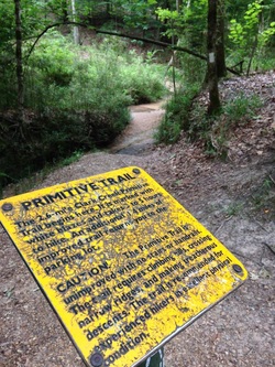 Entrance to primitive trail Entrance to primitive trail Clark Creek 366 Fort Adams Road Woodville, MS 39669 Trail Map Important things to note: *Tunica Hills Wildlife Management Area (WMA) and Clark Creek are NOT the same thing, they are about 15 minutes from each other. There are a few trails throughout the WMA but they aren't the ones with all the waterfalls. Clark Creek is sometimes referred to as Tunica Falls, hence sometimes Tunica Hills are Tunica Falls are confused. *It can get crowded on the weekends. We went on a Tuesday, arriving late morning. When we pulled into the parking lot there was only one other car there. When we left late afternoon the small parking lot was almost full and we saw quite a few groups on the way out. I've read, and heard from friends, that on weekends the trail is packed, so for a more private experience try a weekday morning. We went hours without seeing a hiker on the primitive trail. *Your GPS might bring you to the wrong spot. You can use the address above, which is the one they provide on their website, but it brought us to an empty lot. Its the correct road, the GPS just says its a few more miles past where it actually is. The trail head isn't overly obvious with a big sign and flashing lights, but it is overly obvious in the sense that it's the only establishment around. It'll be on your left where the pavement stops and the dirt road begins. It's marked with a small parking lot and handicap bathroom. *Parking is $3. There's a little box with envelopes and "parking passes" before you enter the trails with a warning that no payment could mean the towing of your car. No one is there to monitor if you put money in or not, but if you appreciate clean, well-kept hiking trails and camping grounds it wouldn't hurt you to pay. We didn't know before hand so we scrounged around for change and ended up just short of $3. Hey, something is better than nothing right? * There are BAD potholes on the roads. On your way there just keep an eye on the holes. There are a few that cover almost the entire road. As you can guess, we had a little trouble finding it. We arrived at Tunica Hills Wildlife Management Area (WMA) thinking we were where we wanted to be. After a few minutes of driving down dirt roads we figured out that wasn't the case. Thankfully I got enough service out there to do a quick Google search and found out the place we really wanted was Clark Creek, which is just over the border into Mississippi. After we unknowingly passed the entrance to Clark Creek we ended up in a scary, run-down neighborhood that reminded me of something out of the movies. You know, the part where they're headed to the middle of nowhere to be killed and they show the last glimpse of what appears to be a human being. Yeah. On instinct we turned around and headed back to the handicap bathroom we had passed up the road, arriving at our destination! There are two types of trails at Clark Creek. The big, main trails they call "Improved" and the primitive "unimproved" trail. Their improved trails are gravel and wide enough to fit 3 or 4 people side by side. They are clear of plants and are distinguishable as the main trails. There is no major terrain that is difficult to hike through these trails. They even provide stairs next to the steep hills. The primitive trail is a whole different story. Do not, I repeat, DO NOT bring children or animals on the primitive trail. The terrain and length is much too difficult. The sign that appears at the beginning of the primitive trail even reads "recommended for experienced hikers in excellent physical condition". You can read about how I apparently fit neither of those descriptions here: 5 Foolish Mistakes I Made in a Single Hiking Trip. But we still made it through the whole trail in one piece, so that's a good sign that you can do it too! There are a few places where you have to cross the creek that can get a little confusing and even some places where you can follow the creek to make the trek a bit shorter and easier. I'll let you figure those out on your own though, the fun in hiking is all about the challenge and adventure! We didn't get to see all the waterfalls that the map claims there are (9) but we did see enough to make the strenuous hike worth it. The best one was not too far into the primitive trail. There are maps posted throughout the trails but I suggest you print the map (linked above) and bring it with you because the primitive trail maps are spaced pretty far apart. Another thing the map claims is that there are "scenic overlooks". Ha. More like sit on this covered bench and stare into overgrown bushes and trees. There's one marked on the primitive trail that we were using as our encouragement to keep going. "We'll just get to the scenic overlook and rest there. It'll be a nice view while we have lunch". We were disappointed to say the least. My only complaints would have to be the confusing parts of the primitive trail that come to a T or cross the creek with no immediate indication of which direction to go, misleading map markings, and the fact that I was expecting more out of the waterfalls. Overall it was a great trail to hike and a great challenge! If you have a day off go check it out! Frequently check for ticks, wear grippy shoes for the hills, be careful on the slippery ground by the waterfalls and your trip will be that much more enjoyable. Happy hiking! I give it: 
4.5 out of 5 suns
If you've been to Clark Creek let me know about your experience in the comments!
|
“Keep your face to the sunshine and you cannot see a shadow.” - Helen Keller 

AuthorMy name is Jessica. I live in Louisiana. I love exploring the outdoors and sharing my experiences. Archives
April 2015
Categories
All
 |
 RSS Feed
